Before Dubai became a global benchmark for smart cities, it lived with a paradox that many fast-growing cities still face today: world-class infrastructure built on top of an informal idea of location.
The city had highways that flowed like arteries, towers that rose faster than maps could keep up with, and neighborhoods that transformed in months rather than decades. Yet for all its ambition, finding a specific place in Dubai was often an exercise in interpretation rather than precision.
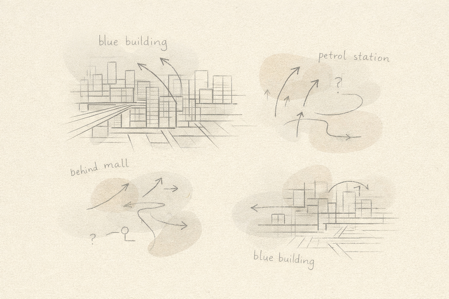
"Behind the mall." "Next to the petrol station." "The building with the blue glass—not the new one; the old one."
These were not isolated exceptions. They reflected how the system functioned at the time.
The Illusion of Familiarity
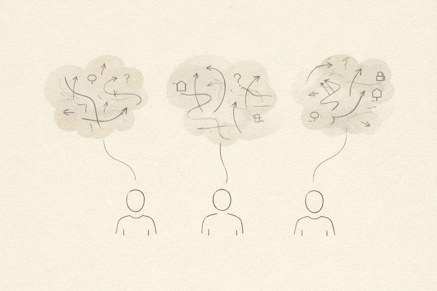
For residents who had lived in the same neighborhood for years, this worked—most of the time. Directions were social knowledge, passed through conversations, WhatsApp messages, and voice calls. Taxi drivers memorized landmarks. Delivery riders learned routes by repetition. Friends guided friends by reference points that existed more in memory than on maps.
But this illusion of familiarity broke down the moment scale entered the equation. Dubai was no longer a city where "local knowledge" could sustain navigation. By the early 2010s, it had become:
- A logistics hub serving millions of parcels
- A tourism destination welcoming visitors from every continent
- A vertical city with thousands of high-rise buildings
- A multicultural population speaking dozens of languages
The city had outgrown descriptive directions, but the addressing system had not caught up.
The Logistics Breaking Point
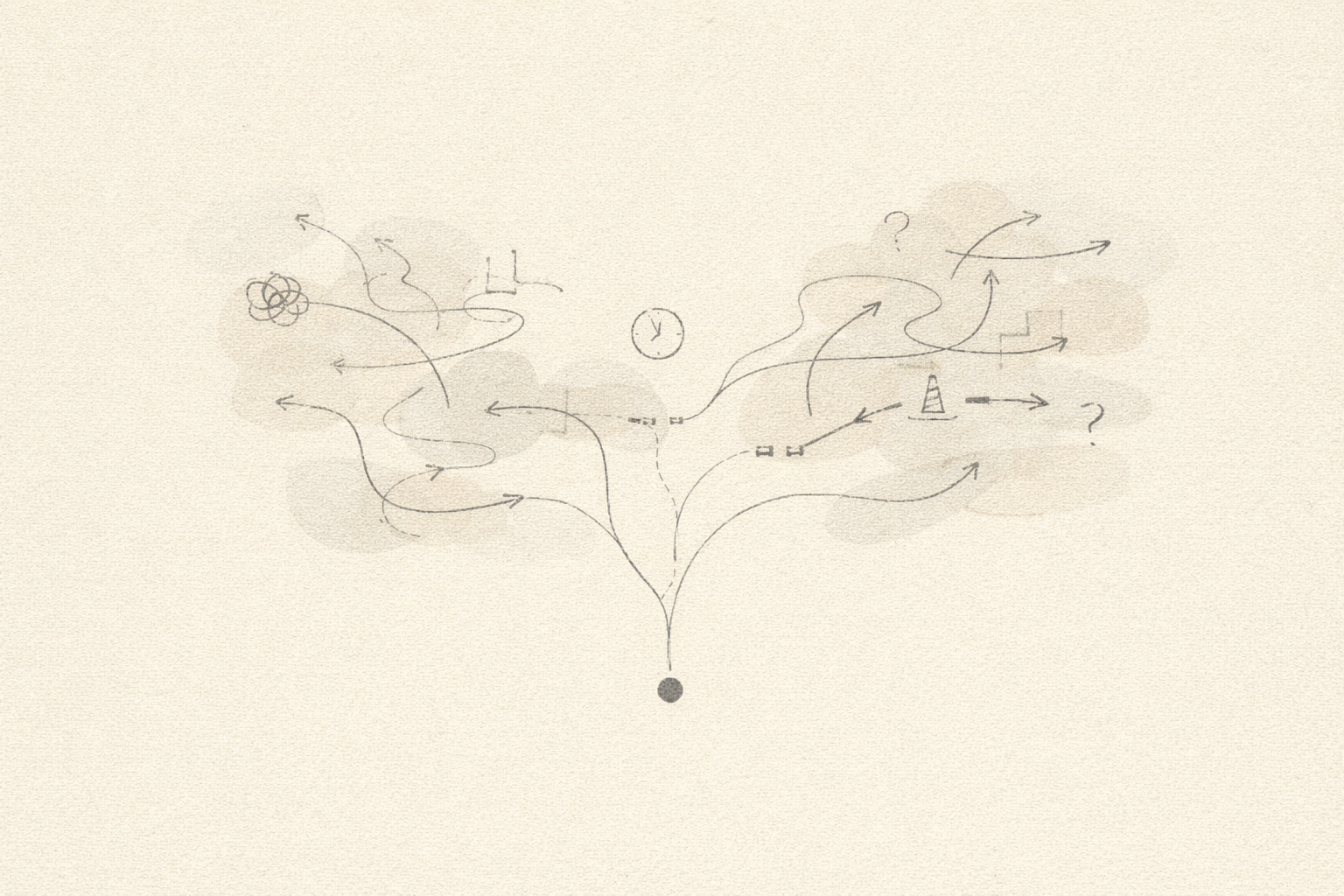
Nowhere were the consequences more visible than in last-mile delivery. As e-commerce accelerated across the UAE, delivery networks encountered a structural problem: drivers could reach the neighborhood but not the destination. Parcels arrived at the "right area" but the wrong building. Calls to customers became mandatory. Repeat attempts became common. Failed deliveries became normalized.
Each failed delivery meant additional fuel consumption, lost driver hours, increased operational cost, frustrated customers, and delayed revenue recognition. At national scale, this was not a minor inefficiency. It was a systemic tax on commerce.
Emergency Response Under Uncertainty

If failed deliveries were costly, emergency delays were dangerous. For police, ambulance services, and civil defense teams, ambiguity in location translated directly into response time. Dispatchers depended on verbal descriptions from callers under stress. First responders arrived in the vicinity, then searched for the correct entrance, sometimes circling buildings or calling back for clarification.
In emergencies, seconds matter.
The absence of a precise, universally understood addressing system introduced uncertainty into moments where certainty was critical. Even with GPS coordinates available, sharing and interpreting them over a voice call was impractical for most people.
What the city needed was not just navigation, but shared location certainty.
Why Global Maps Were Not Enough
One might ask an obvious question: why not rely on global mapping platforms? Dubai already appeared on major digital maps. Roads were visible. Buildings were labeled. GPS could place a user within meters. Yet these tools were designed for general navigation, not municipal precision.
They lacked:
- Authoritative entrance-level addressing
- Unit-level indoor identifiers
- Official integration with emergency dispatch systems
- A single, government-backed reference standard
Maps could show where something roughly was. They could not guarantee how to reach it correctly—or agree on what "correct" meant across agencies, services, and languages. What was missing was not data, but coordination.
The Need for a Different Kind of Address
Solving this problem did not require incremental improvement. It required rethinking what an address was supposed to do.
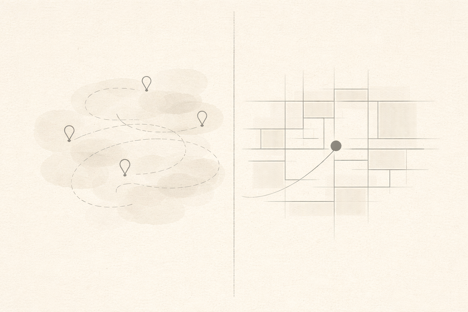
A traditional address describes a place. A smart address pinpoints it.
The city needed an addressing system that was precise enough for machines, simple enough for humans, universal across languages, stable despite rapid urban change, and officially recognized by all services. Most importantly, it needed to be shared—one system used by government, businesses, and residents alike.
This realization marked the beginning of a fundamental shift in how Dubai thought about location. Not as a convenience, but as infrastructure. Not as a map label, but as a digital asset. The solution that emerged would replace ambiguity with certainty, landmarks with coordinates, and local knowledge with a universal language of place.
That solution would be called MAKANI.